Global Container Geofence Library
The Geofence Library provides:
- Version controlled geofences for Ocean Terminals and other Container Facilities
- Relationship to the BIC Facility Code and SMDG Terminal Codes used in API EDIFACT message exchanges for container shipping.
- A single platform for consensus, allowing the industry to collaboratively review and agree upon geofences through industry review panels.
- The ability to easily contribute geofences to a common industry library.
- API accessible: once reviewed and approved, geofences become immediately available via the BIC-SMDG Facility Code API. More information here
- Library download to embed the latest geofences into your system. More information here
What you can geofence:
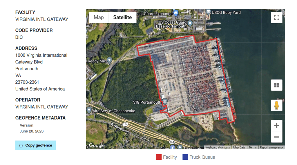
The Geofence Library captures more than a facility’s outer boundary. Alongside the main terminal polygon, users can draw a set of labeled zones that reflect how a facility operates:
- Berth areas — for ocean and barge terminals
- Truck queues — the official queueing area serving a terminal’s gate
- Associated railheads — rail areas that serve a terminal but sit beyond its main boundary
- Gate areas — including the approach to the terminal gate
Each zone carries its own label, so it can be identified and used accordingly.The library holds 4,500+ panel-approved geofences, part of a facility-code database spanning 17,000+ facilities across 160 countries. Approved geofences are served through the joint BIC-SMDG Facility Code API, which handles over 260,000 calls a month.
What is Geofencing?
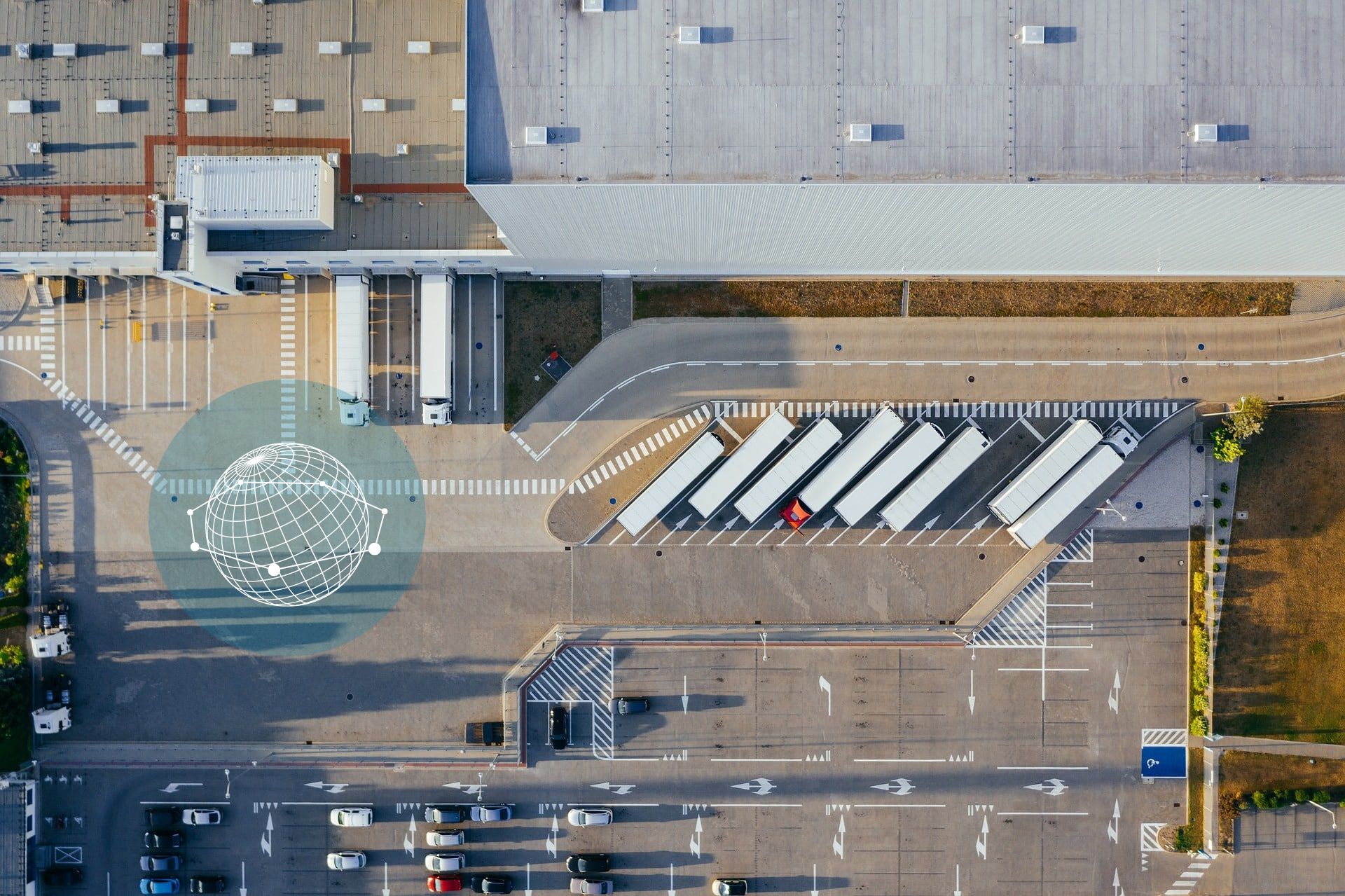
Geofencing is a collection of geo-coordinates used to define virtual boundaries, allowing for real-time triggering of events when an IoT-enabled container enters or exits a designated area. This in turn improves efficiency and accountability within the supply chain.
Who can contribute to the library?
Container facilities can directly contribute their own geofences, as is preferred, but we also accept geofences from:
- Carriers
- Ports
- IoT service providers
- Other local experts.
An industry panel regularly meets to review and approve geofences. These panels are facilitated by BIC and SMDG, but also by regional associations such as IANA in North America. More information here
Why an industry library for geofences?
- Geofences provide context and bolster the case for IoT-equipped containers – improving safety, security and sustainability in the supply chain.
- A global database for geofences means the industry can follow a standard methodology: This has been defined through industry collaboration in a United Nations (UNECE) white paper, available for download here.
- A global geofence library increases interoperability, facilitates transparency and helps supply chain participants to maintain accurate and up-to-date geofences. Changes can be flagged, reviewed, and approved – allowing instant updates throughout the chain.
- Reduces duplicate work and allows for faster adoption.
How to get involved
1
Terminals and Depots
Please contribute the geofence for your own facility. You can easily upload your GeoJson or sign up to draw the boundary via the Geofence Review Tool.
2
Carriers and Ports
Please encourage your contracted terminal and depot facilities to contribute their own geofences. If you already have high-quality geofences available, please consider contributing them – you will get a lot in return. To learn how to bulk contribute, please contact us.
3
Local Experts
The panel is continually looking for industry experts with detailed local knowledge of ports worldwide. Please register your interest in helping in your area by contacting us at [email protected] To learn which port areas will be reviewed in upcoming weeks, see the schedule.

FAQs
To learn how to contribute a set of geofences, please contact us at [email protected]
To draw individual geofences, please go to the Geofence Review Tool to sign up as a contributor.
Geofences submitted by facilities are approved rapidly. Other geofences will be reviewed as quickly as possible. Review times may vary depending on the region.
Coming soon: Once approved, geofences will be visible in the BIC Facility Code database .
Learn how to access the BIC-SMDG facility code API here and consult our documentation on Github.
The BIC provides a convenor for the panel, and the geofence review tool for the panel to review geofences and form a consensus. Additional panels are now being formed and will be convened by other associations (e.g. IANA for North American facilities, SMDG for Ocean Terminals). The panel is an open forum and everyone is welcome to join. A schedule of the areas to be covered is published in advance and we encourage those who have local knowledge of the area or facilities within that area to join and give guidance. Geofences are only approved if there is consensus during the review panel call, and that the rules defined in the UNECE Geofence White paper are adhered to for the provided geofence and Facility Type (e.g. Ocean Terminals require a berth in addition). All reviewed geofences are then made public via the API and BIC website.
Our preference is always to receive a geofence submission from the facility itself and allow them to maintain it. If you find that the geofence is missing or incorrect for your facility it can easily be updated in a few simple steps:
- Visit the Geofence Review Tool and Register an Account
- Search for your Facility Code and follow the instructions to draw a geofence
- Submit the geofence and mark as ‘facility provided’
- You will be notified on completion of review
If the code that’s attached to your facility is not the code that you use in your EDI exchanges, contact us at [email protected]
No. This project involves only facility geofences. The Global Container Geofence Library provides a common, standardized set of geofences which can be downloaded by container owners, operators, shippers, IoT service providers and others to provide context in their smart container tracking systems.
You can consult our documentation on Github, it will provide all the information needed.